
Proposed changes to Māori and Pacific diabetes pathway spark equity concerns
'Alakihihifo VailalaFri, 22 May

Cyclone Vaianu batters northern New Zealand, bringing damaging winds and heavy rain as it tracks south towards Auckland.
Photo/RNZ/Marika Khabazi
Wind gusts of up to 120km/h hit Northland overnight, evacuations carried out, and transport disruptions expected to worsen as the storm moves south.


Severe winds and heavy rain have battered parts of northern New Zealand as Cyclone Vaianu moves south with authorities warning the worst of the disruption may still be ahead.
In Northland, wind gusts reached up to 120km/h at Cape Reinga and Tutukākā Harbour overnight, while other areas saw gusts above 110km/h.
Heavy rain also hit the region with Whangārei recording around 90mm during the warning period.
Six households in Kerikeri were evacuated as a precaution due to the risk from nearby trees while hundreds of homes woke to power outages across the Far North.
State Highway 1 through the Mangamuka Gorge remains closed as crews assess whether it is safe to reopen.
Emergency services say the impact so far has been limited but conditions remain dangerous.
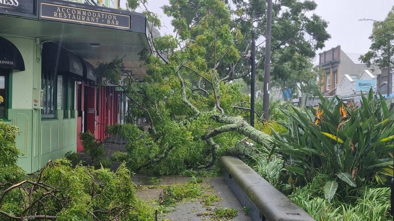
Fire and Emergency New Zealand (FENZ) confirmed crews responded to 12 incidents overnight, mostly involving fallen trees and minor damage to buildings.
Brendan Nally, FENZ's Director of Operations, said in a statement that none of the callouts were life-threatening. But he added teams remain on standby across the upper North Island as the storm tracks south.
Watch an update from RNZ on Cyclone Vaianu below.
Across the region, officials are urging people to stay off the roads unless "absolutely necessary" with strong winds continuing and some rivers still running high despite beginning to recede.
Attention is now turning to Auckland, where authorities warn transport networks could face major disruption later on Sunday.
The Auckland Transport Operations Centre (ATOC) has activated its incident response team and says the Harbour Bridge is at high risk of closure as winds strengthen.
“Based on the current forecast, we expect there could be periods of extended closures of the Auckland Harbour Bridge between midday Sunday until late evening,” Zane Davidson, ATOC Incident Controller, said in a statement.
Fallen trees and strong winds caused disruption across the North Island with emergency crews responding and residents urged to stay off the roads. Photo/RNZ/Robin Martin
Commuters are being urged to check conditions before travelling and consider alternative routes.
“I would strongly advise checking the status of the bridge before you travel from now onward, as the wind trajectory can change quickly and we may see strong gusts from this evening.”
Flooding is also expected to affect low-lying roads, with warnings that conditions could deteriorate quickly as the system moves further south.
Public transport has already been disrupted, with multiple ferry services cancelled and further delays likely throughout the day.
Authorities say extra crews and resources have been deployed across the region with emergency teams, transport agencies, and weather services working closely together.
Meanwhile, Tauranga has declared a state of emergency with officials warning up to 800 properties could be hit by coastal flooding and others at risk from erosion.
Mayor Mahe Drysdale urged residents in low-lying areas to leave early if they feel unsafe, as dangerous swells and worsening conditions are expected to peak around Sunday’s high tide.

Strong winds caused disruption across Northland overnight, with emergency crews responding and residents urged to stay off the roads. Photo/RNZ
For now, the message across the upper North Island is clear: stay alert, stay informed, and avoid unnecessary travel as Cyclone Vaianu continues to move through Aotearoa.
For the latest MetService updates, click here.