
Visa-free travel and wage freezes spark fresh split in Pacific candidates debate
Christine RovoiWed, 21 Oct

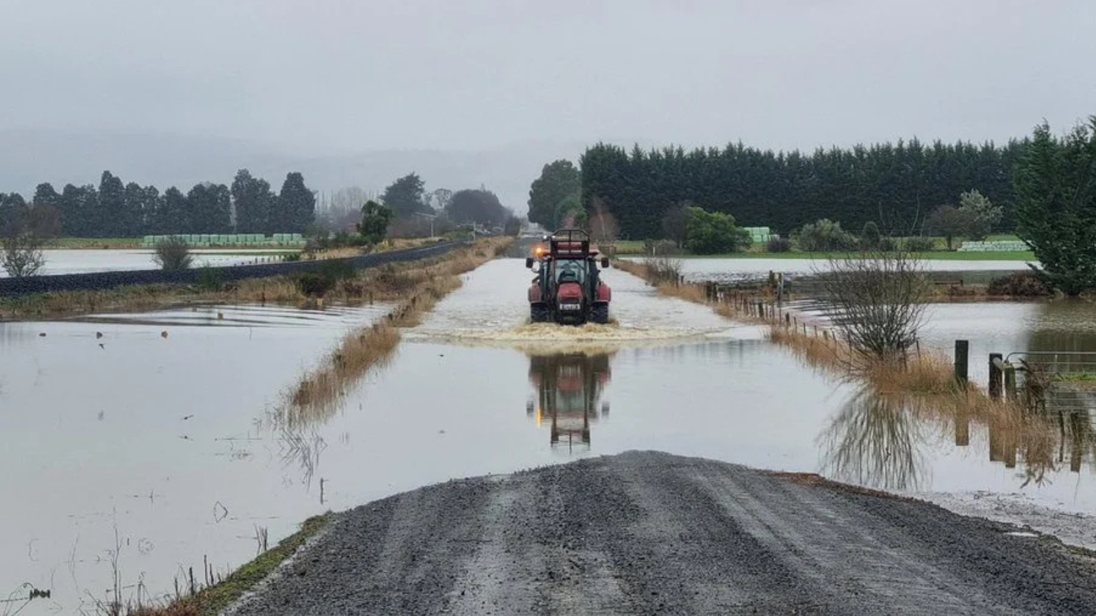
State Highway 8 between Fairlie and Lake Tekapo was partially submerged earlier on Monday as heavy rain and flooding swept across South Canterbury, forcing drivers to slow or divert amid hazardous road conditions.
Photo/RNZ/NZTA Waka Kotahi
A rare Red Heavy Rain Warning remains in place for parts of the South Island as flooding, slips and travel disruption hit multiple regions, with more wet weather now spreading further north.




Severe weather is continuing to lash New Zealand with a rare Red Heavy Rain Warning in force for parts of the lower South Island as officials warn of flooding, slips and dangerous river conditions.
The warning covers coastal Dunedin and Clutha where MetService says 80-120mm of rain has fallen or is expected - the most intense downpours affecting already saturated ground.
MetService said the alert was issued to help communities and councils respond before conditions worsened.
“It is also enabling councils to prepare people who are in those areas along coastal Dunedin and Clutha for this heavy rain event,” it said.
The Red Warning is the highest level issued by MetService and signals the risk of significant and dangerous impacts including surface flooding, rising rivers and road closures.
Civil Defence teams have been active across the lower South Island with emergency hubs opened in parts of Otago and sandbag stations operating in flood-prone areas.
Emergency services have also reported dozens of callouts linked to flooding and slips.
In Waitaki, authorities have declared a state of emergency as conditions intensified, with officials warning people to avoid unnecessary travel and stay alert to local updates.
At the peak of the flooding, emergency services reported widespread disruption across Dunedin, with around 18 roads closed and multiple suburbs affected by surface flooding and slips.
Evacuation centres were opened during the height of the storm as some residents were moved from their homes, while Civil Defence teams worked through the night responding to flood-related callouts and monitoring rising river levels.
Further north, Marlborough and Canterbury are now under Orange Heavy Rain Warnings with inland areas expected to receive significant rainfall through Monday and Tuesday.
A wider Heavy Rain Watch is also in place across parts of Canterbury while Southland and the West Coast remain under active weather alerts.
MetService says the same weather system is continuing to move across the country, bringing a mix of heavy rain, strong winds and colder conditions to multiple regions over the next 48 hours.
Flooding across Gladstone Road South in Dunedin on Monday morning. Photo/RNZ/Tess Brunton
In Canterbury, forecasters warn that river levels may rise quickly, with surface flooding and travel disruption likely in low-lying and inland areas.
Further north, parts of the North Island are also being affected with periods of heavy rain and strong winds forecast for exposed areas.
While conditions are less severe than in the South Island, authorities are warning people to stay updated as the system tracks north.
MetService has repeatedly advised the public to prepare for slips, flooding and hazardous driving conditions, particularly in areas already affected by recent wet weather.
The agency says warnings and watches remain active across the country and may be updated as conditions change rapidly.
For more updates on the weather, visit metservice.com