
‘He was our superhero’: The legendary Jonah Lomu’s Tongan story comes to the big screen
Aui'a Vaimaila Leatinu'uMon, 03 Aug
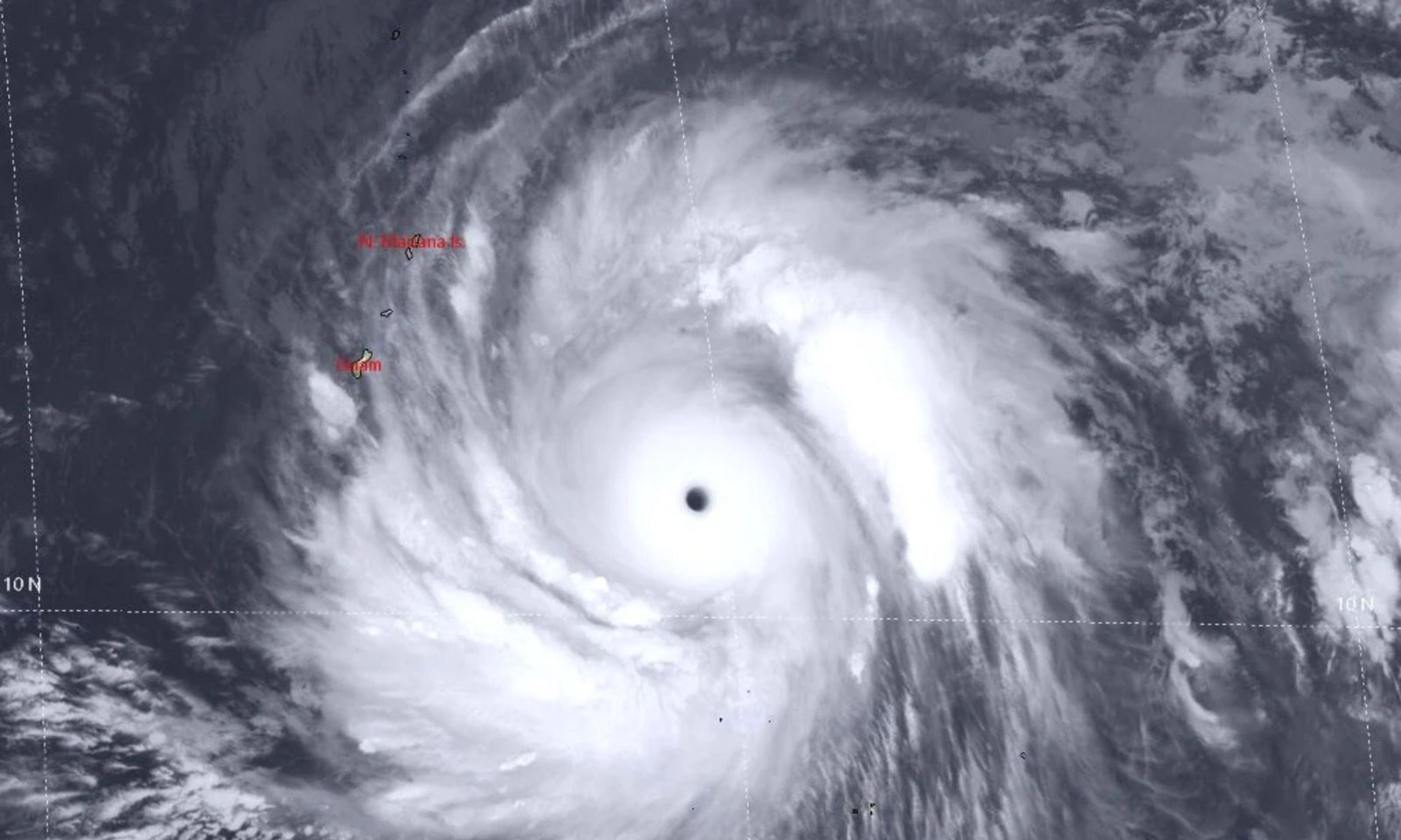
Satellite imagery shows Super Typhoon Sinlaku as it tracks across the Pacific, captured by the Joint Typhoon Warning Centre on 13 April 2026.
US territories move into Condition of Readiness 1 as the storm, with winds of up to 180mph, approaches the region, bringing the risk of damaging winds, heavy rain, and dangerous surf.


Guam, a US Pacific territory, is preparing for dangerous conditions as Super Typhoon Sinlaku moves closer to the Marianas.
Saipan, Tinian, and Rota were placed under Condition I on Monday afternoon.
Officials warn of destructive winds, flooding, and life-threatening surf from Monday night.
Guam is a US territory in the western Pacific Ocean. It was taken from Spain in 1898 and is now an important US military hub in the region.
People born in Guam are US citizens, and the island has its own local government, but residents cannot vote in US presidential elections.
The island has entered Condition of Readiness 1 (COR 1) on Monday, meaning destructive winds are expected within 12 hours.
Residents are being told to stay indoors until the all-clear is given after the storm.
The Joint Information Center has urged people to stay out of the water and move to safe shelter immediately where needed.
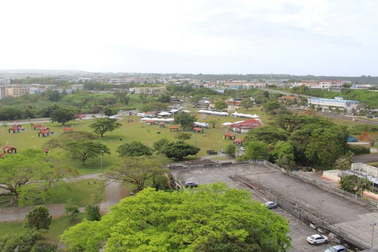
Calm weather over Guam ahead of Super Typhoon Sinlaku, as the US territory prepares for damaging winds, heavy rain and dangerous surf. Photo/American Red Cross, Guam
Weather officials say Guam could face 36 to 40 hours of damaging winds from Monday night through Wednesday although the chance of the worst of the storm hitting the island directly is now lower as Sinlaku tracks further north.
At a briefing on Monday, National Weather Service meteorologist-in-charge Brandon Aydlett said the system is becoming better defined as it moves towards Saipan and Tinian.
He said it is now unlikely the strongest winds at the centre of the Category 5 super typhoon will shift far enough south to directly hit Guam.
“It’s been a while since we’ve seen one this mature,” Aydlett said, adding it was “quite a bit more powerful than what we had with Mawar as it was approaching the Marianas.”
He said Guam is more likely to see 30 to 60 hours of tropical storm conditions, with winds of around 50 to 60 miles per hour, stronger gusts and heavy rain as the storm passes to the north.
Storm-force winds are expected to begin Monday night and continue into Wednesday, with the worst conditions likely on Tuesday.
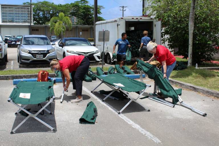
Residents secure homes and prepare emergency supplies as authorities warn of damaging winds and heavy rain from Super Typhoon Sinlaku. Photo/American Red Cross, Guam
“Because Guam is getting only tropical storm conditions, it doesn’t mean that the storm itself has weakened. It means that we are far enough away from the centre of their strongest winds,” Aydlett said.
Forecasters say there is still some uncertainty in the track with about a 66 per cent chance Sinlaku stays within its current path. That could still place the eye as far south as just below Rota or further north across the Marianas.
Officials say there is also a smaller chance, about 33 per cent, of the storm shifting further north or south, including a low risk of a closer pass to Guam.
Typhoon-force winds extend about 60 miles from the centre while tropical storm-force winds can stretch up to 275 miles. This means impacts will be felt far beyond the eye of the storm.
Even if Guam avoids the worst winds, officials warn flooding and coastal hazards remain a serious risk.
Aydlett said Sinlaku’s peak intensity with sustained winds of around 180mph and gusts well above 200mph could be reached as it passes the region.
He also warned that Saipan and Tinian could face winds of up to 145mph as the system tracks across the northern islands.
As of Monday morning, Sinlaku was about 290 miles east-southeast of Guam. A surf warning and flood watch remain in place for the island.
Officials are urging residents to stay out of the ocean, avoid jetties and piers, and stay away from flood-prone areas. “Stay out of the water,” the Joint Information Center said in a statement, warning of life-threatening surf conditions.
High surf warnings remain in effect, with waves of 10 to 15 feet expected for Guam, and up to 25 feet for Rota, Tinian, and Saipan.
A coastal flood watch is also in place through Wednesday, with possible flooding of up to three feet on Guam and higher levels in the northern islands.
Authorities continue to urge people to monitor updates closely as Sinlaku moves through the region.